
Gravel GPS for where the tarmac ends
Gravel riding is half navigation. The road turns to track, the track forks, and the fork you want is on a topographic map rather than a road map. That calls for a big screen and a way to redraw the route without stopping to open a laptop.
What gravel asks of a GPS
- A map with the tracks on it
- Road maps stop where gravel starts. A topographic map shows the tracks, paths and contours between villages, and it needs to be on the device for the stretches with no signal.
- Room to read the fork
- Choosing between two tracks is easier on a bigger screen. The Terra has 3.7 inches at 480 x 640 pixels, built to stay readable in direct sunlight.
- Changing the plan on the spot
- A washed-out track or a closed gate means a new route. The Terra lets you create a route point to point on the device, modify one, or make a variant.
- Finding what is nearby
- The Terra can show unmarked paths and points of interest close to your current position, useful when the day runs long and you need water or a way back.
Our pick: TwoNav Terra
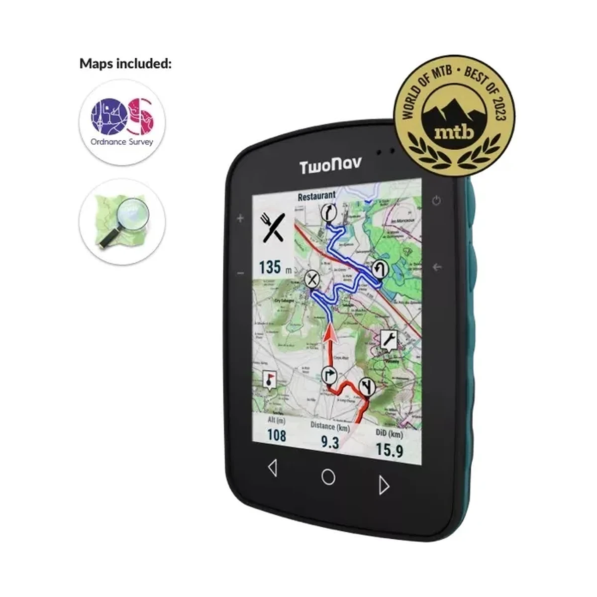
The Terra is the big-map unit: 3.7 inches, readable in direct sunlight, with routes you can create or change on the device. World of MTB named it the best MTB GPS of 2023.
| Specification | TerraOur pick | Roc |
|---|---|---|
| Made for | Cycling, hiking, water sports | Cycling |
| Screen | 3.7" | 2.7" |
| Resolution | 480 x 640 | 240 x 320 |
| Weight | 198 g | 120 g |
| Size | 80 x 115 x 19 mm | 58 x 90 x 20 mm |
| Battery life | 15 h | 18 h |
| Battery | Built in | Built in |
| Storage | 32 GB | 32 GB |
| Satellites | GPS, Galileo, Glonass, BeiDou | GPS, Galileo, Glonass, BeiDou |
| Wireless | Dual Bluetooth, Wi-Fi | Dual Bluetooth, Wi-Fi |
| Water and dust | — | — |
| Controls | 7 buttons | 6 buttons |
Or the Roc. Choose the Roc if you would rather carry 120 g than 198 g. It has a 2.7-inch screen and lists 18 hours against the Terra's 15. See the Roc
Figures are the manufacturer's. The full four-way comparison is on the cycling GPS page.
Questions riders ask
ASPL is the authorised distributor for TwoNav in India and services the devices in its own service centre. Ask us anything the answers here leave open.
Why a topographic map for gravel?
Road maps show roads. Gravel routes use farm tracks, forest roads and paths that only a topographic map shows, along with the contours that tell you a climb is coming.
Can I plan a route on the device itself?
Yes. The Terra lets you create a route point to point, modify an existing one, or make a variant, without a computer.
How long does the Terra run?
The manufacturer lists 15 hours. If your days run longer, the Cross Plus lists 20 hours and the Aventura 2 Plus 36 hours.
Read before you ride
- How to choose a cycling GPS in IndiaBattery life, maps that work without signal, a screen you can read at noon, the sensors you already own, and who repairs it. Six checks before you buy a bike GPS.
- TwoNav Roc vs Terra vs Cross Plus: which one for your ridingThree TwoNav units a cyclist will weigh against each other. The Roc is the light one, the Terra has the big map, and the Cross Plus is the one rated for weather and sensors.
- Bikepacking navigation in India: maps, battery and a backup planA multi-day trip is a navigation problem before it is a fitness one. Maps for every stretch, battery between sockets, the points that matter, and a backup.